Ready for High-Flying Careers: MSJC’s Drone Certificate Program Welcomes Students This Spring

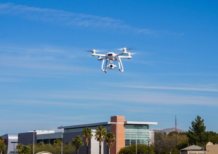
When Mt. San Jacinto College (MSJC) professor and Geospatial Sciences Information Chair Dr. Roy B. Mason noticed a utility truck parked on his street, he immediately recognized the drone whirring in the sky.
At the time, Mason was helping to develop the college’s new Drone Applications in Geospatial Information Science (GIS) certificate program that is set to debut in spring 2023. Students can enroll now.
“I asked [the workers] if they could tell me a little bit about what they were doing,” recalls Dr. Mason. “They explained to me that their company had been hired by SCE and they were basically inspecting every electrical line that SCE has. 
“I said, ‘You don’t have to tell me, but what kind of money are you making?’ Then he tells me $80,000 a year,” Mason said. “That blew me away.”
The conversation exemplified how crucial the new Drone Applications in GIS certificate program is to help students land in-demand, high-paying jobs and careers in the growing drone field. According to a 2022 Orange County Center of Excellence Report, only 15 community colleges across California offer drone-related programming. Mt. San Jacinto College is the only community college in the region — and state — offering a drone-related certificate program.
“There are many, many job opportunities out there,” Mason explained. “That’s why we’re really honing in on this. We want to get an inroad into that market.”
Even though MSJC is one of the first colleges to offer the certificate program, it’s doubtful they will be the last. Job opportunities as a drone or unmanned aerial systems (UAS) pilot are rapidly popping up throughout the region, state, and country. According to data from the Burning Glass Institute, drone-related online job postings grew by 50 percent from 2021 to 2022 alone. 
“Students have the opportunity to get involved with a field that is still in its infancy,” explained Dr. Jason Hlebakos, MSJC professor and Environmental Studies Department Chair.
MSJC’s eight-month Drone Applications certificate program allows students to learn the basics of drone operations in the GIS field. With the college’s newly remodeled GIS lab, state-of-the-art computers, and an expansive fleet of drones, the program is ready to welcome the inaugural group of students this spring with the hands-on experience required to soar.
“Getting in on the ground floor means growing along with the industry and being well-poised to take advantage of new prospects as they arise,” says Dr. Hlebakos. “Students who take the initiative today have a great potential to grow into leaders in the field.”
Within the Inland Empire/Desert region, drone-related education is being introduced to students as early as middle school. Through new program developments, MSJC and local K-12 schools are forming valuable partnerships as an introduction to this growing career pathway.
“Our partnership with MSJC establishes a continuum of STEM opportunities from middle school to MSJC,” shares Commander William Lauper, Senior Naval Science Instructor at Chaparral High School in Temecula.
Through the collaboration between MSJC and Chaparral, introductory drone pilot preparation courses became available for his Navy Junior Reserve Officers Training Corps (NJROTC) cadets.
“Student interest has grown for this second course offering, with many juniors entering the Chaparral High School NJROTC for the first time for the opportunity to take this class,” Lauper said. “Interest at the middle school has also grown, which will establish a sustainable pipeline of students for years to come.”
Introduction at the high school level is essential for the progression of drone-related career opportunities within the region, Mason said.
“The big push has been for students to go off to the university, but so many of them don’t make it,” explains the MSJC professor. “They’re looking for other things. And so, we really see this as maybe one of our vocational career programs that is going to have real interest to our students.”
Two current GIS students at MSJC, Danny Chappell and Anthony Delgadillo, say the addition of the certificate will benefit their future career opportunities.
“Courses like the drone applications certificate program offer a great opportunity to learn a skill that will definitely carry on and grow in the future,” explains Chappell. “It offers great hands-on experience by learning how to fly a drone and the various ways you can use that information within GIS.”
Delgadillo adds, “Acquiring a drone certificate in conjunction with GIS will definitely set my professional bar a bit higher and will be able to offer more than what I currently do.
“As a Gen-Xer, I have to adapt, change, and learn … not only to improve my skills, but to be ahead or current with knowledge and technologies.”
As the first-ever semester of the Drone Applications in GIS certificate program rapidly approaches, Mason says he expects the program to soar.
“I really anticipate that these drone courses that we’re offering Spring term are going to fill up and max out very quickly.”
Learn more about the Drone Applications in GIS certificate program by visiting the MSJC website.